Historical Context Map
This map overlays the historic 2.5-million-acre Fairfax Northern Neck proprietary—the land between the Potomac and Rappahannock Rivers, once owned by the sixth Lord Fairfax—onto a modern map base. While historic versions of the proprietary map are available online, this presentation uniquely situates it within contemporary cartography, making it easier to understand its scale and location in today's context.
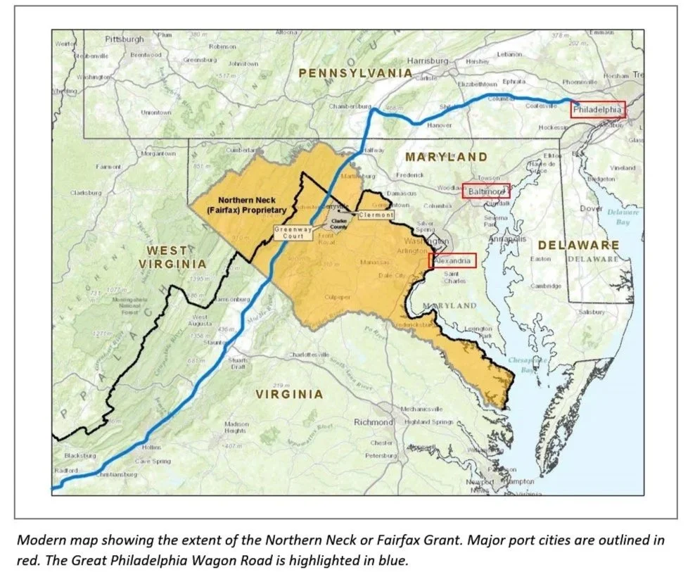
Northwest is modern Pittsburgh (18th-century Fort Duquesne/French, Fort Pitt/British American), the owners of Clermont were involved in the French and Indian War (1754-1763) and in the Revolution (1775-1783), in both of which the fort at Pittsburgh played an important role.
Northeast is Philadelphia, the northern beginning of the Great Philadelphia Wagon Road (in blue), and an Atlantic international port which served the grain trade out and imports in, including milling machinery for grain/corn. Political center for Revolution and a new country.
Southwest is the Blacksburg/Roanoke area, through which the Great Philadelphia Wagon Road passed, carrying settlers to NC, TN, and KY
Southeast is Hampton Roads, with Norfolk and Portsmouth.
The red boxes underline the three major international ports supporting importing and exporting from Clermont: Alexandria (Fairfax Rd, Rt 7), Baltimore (Rt 340), and Philadelphia, and the fact that there were existing roads in the second half of the 18th century when Clermont was surveyed and began production.